|
|
 |
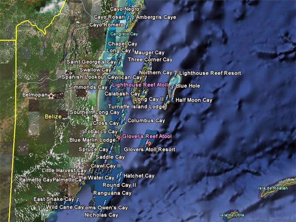
Cayes and Atools Map and Guide
|
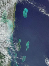
Close to the magnificent Barrier
Reef along the coastline of Belize, hundreds of coral and mangrove
ilands known as cayes bask in the shimmering, clear turquoise and
emerald green waters of the Caribbean. Ranging from isolated
stretches of sand and palm trees to very large islands like Ambergris
Caye.
|
|

Click any Pictures to enlarge
|
| Belize’s
cayes offer excellent
diving, fishing, scuba, snorkeling and swimming opportunities.
For
four atolls in the Western Hemisphere, three of them are located in
Belize. Situated beyond the barrier reef these long coral isles
surrounding lagoons are popular and idyllic destinations as well as
ideal places for water sports. |
AMBERGRIS CAYE
25 miles long, Ambergris Caye is the largest and most developed caye,
with plenty of resorts, lodges and organized activities around the only
town, San Pedro. Ambergris
Caye 
CAYE CAULKER
The second largest, at five miles long by one half mile wide, with more
budget-oriented lodges, and a good range of activities. Caye
Caulker
GLOVER ‘S REEF
Glover’s Reef Atool
is a Marine Reserve, a World Heritage site. The most
remote of the atolls, Glover’s Reef is about 70 miles southeast of
Belize City. The far out location makes this one of the most
pristine areas in Belize. Once the base of pirate John Glover, now
boaters, divers and anglers flock to this isolated island .
Around Glovers Reef you find Northeast Caye
Long Caye
and the
Southwest Cayes
Brilliant blue waters with excellent scuba diving,
snorkeling, fly fishing, kayaking and camping are all available here.
LIGHTHOUSE REEF
The Lighthouse Reef Atoll
is a panorama of swaying palms, powdery white
beaches, striking coral formations and turquoise waters. It is
the only atoll with a private airstrip and the nearest atoll to the
Blue Hole.
Looking from the air like a dark blue cavity in a
field of turquoise, this almost perfectly circular underwater cave is
Lighthouse Reef’s most spectacular natural wonder. The cave
measures 300 meter in diameter and 160 meter deep, and was made famous
by the French Jacques Cousteau, who explored the fascinating site
in 1972.
At the southeast corner of Lighthouse Reef is the Half Moon Caye
Natural Monument, the country’s first national park It is home to
reptiles, turtles and a large diversity of birds, including thousands
of red footed boobies.
SOUTH WATER CAYE
Located less than half an hour by boat from the town of Dangriga, South
Water Caye
is one of Belize’s most idyllic cayes. The 15-acre coral
island, resting right atop the barrier reef is an excellent area for
diving. International Zoological Expedition’s cottages and student
dorms are based near the center of the island.
ST. GEORGE’S CAYE
The tiny, crescent-shaped St. George’s Caye
is the most historic of all
the offshore cayes. It was here that the British established the
territory’s first real settlement and where the Spanish made their last
ditch effort to conquer Belize on September 10. 1798. Belizeans
still commemorate this battle annually as St. George’s Caye Day.
TOBACCO CAYE
Located on the northern tip of the South Water Caye Marine Reserve the
nine-acre Tobacco Caye
was used for years as a trading post and fishing
camp. Now, because of its close proximity to the Barrier Reef it
is a frequent destination for divers and anglers.
TURNEFFE ISLANDS
The Turneffe Atoll
is the largest of Belize’s three atolls. It is
home to several small, pristine cayes accented with palm trees, white
beaches and mangroves. Only a few hundred yards from the Barrier
Reef, the islands offer excellent diving, snorkeling and fishing
opportunities.
|
Attraction
|
|
|
This
page will be updated with a new map a new quide and new pictures later
this year. Please come back
Birdwatching, Snorkeling, Diving, Kayaking and Fishing
|
|
 |
|
|
|
|
Weather
|
|
GTB Weather
|
 |
Quick News
|
|
|
Site
Search
|
|
|
|
|
|
|
|
|