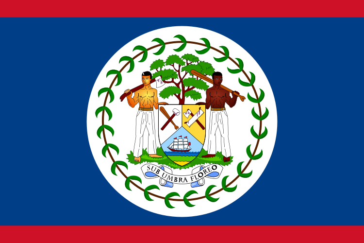
Capital
Belmopan (population 5'0000)
Airport:
Belize-City Philip S.W. Goldson International close to Belize City
Best
Travel Time
From October till January
Currency:
Belize-Dollar (1Bz$ = 100 cents)
Code: BZD
Symbol: BZ$
Weights &
Measures
Metric und US
Electrical Plugs
110 Volt 60 Hz US Standard Plug
Language
English Official language
Krioal and Spanish are recognised regional languages
Religion
Christians (75%) mostly Roman Catholics and Protestants. Much of the
remaining population are Taoists, Buddhists and followers of more
recently introduced religions such as Jainism, Islam,
Bahá'í, and the Rastafari movement.
Government
Parliamentary democracy and Constitutional monarchy.
Time
Zone
MEZ - 7 houres
GMT/UTC -6
Country Dialing Code
+501
Geography
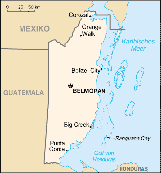
Belize is located between the Hondo and Sarstoon Rivers,
with the Belize River flowing down in the centre of the country.
 The north of Belize consists mostly of flat,
swampy
coastal plains, in places heavily forested. The flora is highly diverse
considering the small geographical area.
The north of Belize consists mostly of flat,
swampy
coastal plains, in places heavily forested. The flora is highly diverse
considering the small geographical area.
The south contains the low mountain range of the Maya
Mountains. The highest point in Belize is Doyle's Delight at 1,124 m.
(3,688 ft).[6]
The Caribbean coast is lined with a coral reef and some
450 islets and islands known locally as cayes (pronounced "keys"),
forming the approximately 200 mile (322 km) long Belize Barrier Reef,
the longest in the western hemisphere and the second longest in the
world after the Great Barrier Reef. Three of the four coral atolls in
the Western Hemisphere are also located off the coast of Belize. Belize
is also the only Central American country without a coast on the
Pacific Ocean.
The climate is tropical and generally very hot and humid. The rainy
season lasts from May to November and hurricanes and floods are
frequent natural hazards.
Climate
Belize has a tropical climate with pronounced
wet and dry seasons,
although there are significant variations in weather patterns by
region. Temperatures vary according to elevation, proximity to the
coast, and the moderating effects of the northeast trade winds off the
Caribbean. Average temperatures in the coastal regions range from
24° C
in January to 27° C in July. Temperatures are slightly higher
inland,
except for the southern highland plateaus, such as the Mountain Pine
Ridge, where it is noticeably cooler year round. Overall, the seasons
are marked more by differences in humidity and rainfall than in
temperature.
Hurricanes have played key--and devastating--roles in Belizean history.
In 1931 an unnamed hurricane destroyed over two-thirds of the buildings
in Belize City and killed more than 1,000 people. In 1955 Hurricane
Janet leveled the northern town of Corozal. Only six years later,
Hurricane Hattie struck the central coastal area of the country.
Important Cities
The largest cities in Belize are (conditions 1 January 2005): Belize
town center of 61,461 inhabitants, San Ignacio of 16,812 inhabitants,
orange mill Town of 15,298 inhabitants, Belmopan of 13,381 inhabitants
and Dangriga of 10,750 inhabitants.
Belize
City was founded (originally as "Belize Town") in the mid 17th century
by British lumber harvesters. It had previously been a small Maya city
called Holzuz.

Belize
Town was ideal for the British as a central post because it
was on the sea and a natural outlet for local rivers and creeks down
which the British shipped logwood and mahogany. Belize Town also became
the home of the thousands of African slaves brought in by the British
to assist in the forest industry. It was the coordination site for the
1798 Battle of St. George's Caye,
won by the British against would be
invaders, and the home of the local
courts and government officials up to the 1970's.
For this reason,
historians often say that "the capital was the Colony", because the
center of British control was here.
Belmopan
Belmopan
was constructed just to the east of Belize River, 80 km (50 miles)
inland from the former capital, the port of Belize City, after that
city's near destruction by a hurricane in 1961. The government was
moved to Belmopan in 1970, and its National Assembly Building is
designed to resemble a Pre-Columbian Maya temple.
Nature
Rainforest
Half of Belize is covered by dense rainforest, and eighty percent of
its rainforest remains under government protection, much of it
unexplored. These tropical forests provide habitats for a wide range of
animals including jaguar, puma, ocelot, armadillo, tapir and crocodile.
For those with the spirit to venture off the beaten track, the natural
and cultural diversity of Toledo makes a visit to Southern Belize a
unique adventure.
Births
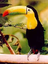
Belize has recorded over 540 species of birds within its
borders. Because of Belize's small population and lack of industry,
much of Belize has remained virtually undisturbed. About 60% of the
country is still forest therefore creating the perfect habitat for
birds and wildlife.
Coast and Reef
The Belize Barrier Reef is a series of coral reefs
straddling the coast of Belize,
roughly 300 m (0.2 mile) offshore in the north and 40 km (25 mile) in
the south. It extends for about 300 km (185 miles), making it the
second largest coral reef system in the world after the Great Barrier
Reef
in Australia. It is Belize's top tourist destination, attracting almost
half of its 260,000 visitors, and vital to its fishing industry .
Demographics
Poulation Structure
Racial tension is very uncommon because of the constant admixture of
the different ethnic groups. Many people simply identify as "Belizean".
Because of this, the ethnic composition of the country is sometimes
hard to determine, but self identified Mestizos comprise 50% of the
population, and Kriol 25%. The Indigenous Mayan also make up a good
percentage of the Belizean population at 11%. The rest is a mix of
Garifuna, Mennonite German farmers, South Asians,
other Central Americans, whites from the United States of America, and
many other foreign groups brought to assist the country's development.
Not surprisingly, this mix creates an equally interesting mix of
language and communication.
Language
English
is the official language because Belize was a British colony and still
has ties to Britain. However, most Belizeans use the more familiar
Belize Kriol,
a raucous and playful English-based language that contains colourful
terms that are usually translatable in English with a Spanish twist.
Spanish
has become important as the mother tongue of Mestizo and Central
American settlers, and is a second language for much of the country.
Less well known are the ancient Maya dialects, Garifuna
(which is a mixture of the Carib language, Yoruban, French, and
Spanish, and is also spoken in some communities in Honduras, Guatemala
and Nicaragua) and the Plautdietsch dialect of the Mennonites. Literacy
currently stands at nearly 80%
History
Before European contact
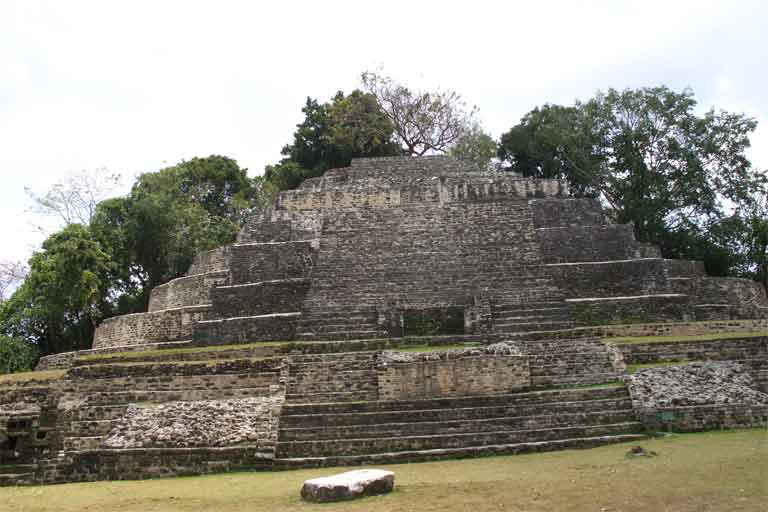
Temple
at
Lamanai
The
area now comprising Belize was originally inhabited by the Maya. The
Maya civilization rose in the Yucatán Peninsula to the north,
spreading to Belize between the 16th century BC and the 4th century
AD.
The Maya people excelled at farming. Their primary crops included corn,
beans, chilies, squash, and cocoa. Pottery, fabric making, stone work,
and architecture grew to a sophisticated level as their civilization
progressed. Their achievements in mathematics and astronomy were
advanced well beyond other comparable cultures of the time.
The Classic period sites flourished until about the 13th century,
and suggest that the area had a much denser population in that period
than it has had since. Post-Classic sites continued until contact with
Europeans. Belize contains the archeological remains of cities such as
Altun Ha, Caracol, Cahal Pech, Lamanai, Lubaantun, Nim Li Punit,
Santa Rita, and Xunantunich.
First European contact
European contact began in 1502, when Christopher
Columbus sailed along the coast of Belize but did not land on shore.
In
1511, the first Europeans set foot on what is now Belize: a small crew
of shipwrecked Spanish sailors, who landed in what is now northern
Belize. The group's galleon
had run aground on the Alacranes reef near Cabo Catoche. Twenty people
were washed ashore, and most of those were immediately captured by the
Mayas and later sacrificed or taken as slaves. One of the prisoners,
Gonzalo Guerrero, later defected to the Mayas, and married into a noble
Mayan family. Guerrero married the daughter of Nachankan, the chief of
Chetumal, and assumed the Mayan way of life. He and his wife had three
children, who were the first mestizos,
Though
tradition has it that European settlement began in 1638,
there are no historical records of Europeans staying year-round in the
area until the 1670s. These early "Baymen" were drawn by the large
stands of logwood, a valuable tree whose sapwood was widely used in
Europe to dye clothing. In the early 1700s, mahogany also became a
valuable export. Over the next 150 years, more English settlements were
established. This period also was marked by piracy, indiscriminate
logging, and sporadic attacks by Indians and neighboring Spanish
settlements.
The British
arrive
The Spanish Empire granted the United Kingdom
rights to establish logging camps in the area, but not to set up a
colony on this land, which the Spanish Crown wished to maintain
theoretical sovereignty over. While not an official British colony,
British use and occupation of the area increased. In 1798, the United
Kingdom and Spain went to war, and the Spanish Governor-General of
Yucatán sent a fleet of 32 ships to seize the British
settlements. From September 3 through September 10
a series of battles was fought around the islands and reefs off the
Belizean coast, after which the Spanish forces withdrew. This is known
as The Battle of St. George's Caye, and is celebrated as a national
holiday each September 10.
The United Kingdom first sent an official representative to the area
in the late 18th century but Belize was not formally termed the Colony
of British Honduras until 1840. It became a Crown Colony in 1871.
In second half of the 19th century many refugees from the Caste War of
Yucatán settled in the northern part of the colony.
According to the 1904 census of British Honduras, the principle towns
of the colony at the time had the following populations: Belize City:
9969; Stann Creek Town: 2459; Corozal Town: 1696; Orange Walk Town:
1244; Punta Gorda: 706; San Ignacio Cayo: 421; Monkey River: 384; and
Mullins River: 243.
In the 20th century,
several constitutional changes were enacted to expand representative
government. Full internal self-government under a ministerial system
was granted in January 1964. The official name of the territory was
changed from British Honduras to Belize in June 1973.
Independence
The government of Guatemala
long claimed that Belize was rightfully Guatemalan territory,
supposedly inheriting rights to the land from the Spanish Crown. Fear
of invasion by Guatemala long delayed the independence of Belize.
Finally the United Kingdom agreed to defend Belize from invasion if
necessary after independence; this agreement led to full official
independence granted on September 21, 1981, under the leadership of
long time Prime Minister and independence advocate George Price.
Guatemala refused to recognize the new nation until 1991.
Belize City was hit badly by a hurricane in 1931, and suffered even
more severe damage from Hurricane Hattie in 1961. This resulted in the
creation of two new towns. The first was Hattieville,
just inland from Belize City, which was originally intended as a
temporary shelter for those made homeless by the hurricane, but which
grew into a permanent town. The second was Belmopan, a community
planned as the new capital of Belize, well inland and near the center
of the country.
The building of Belmopan began in 1962, and in 1971
the Belizean House of Representatives began meeting there. Although no
longer the capital, Belize City remains the nation's largest city and
port. In the 1990s a new sea port was built at Big Creek, which soon
became the second most important port after Belize City.
Tourism has become the mainstay of the economy. The country remains
plagued by high unemployment, growing involvement in the South American
drug trade, and increased urban crime in Belize City. The British army
continues to man bases in South America.